GIS Land Surveyor
GIS Land Surveyor
Typical Application
The application of GIS data collector in land system mainly includes land survey and land law enforcements. Hi-Target Q series products have been widely used in the second land resources survey and mining rights survey successfully. In the protection of basic farmland project of a land and resources system in East China, we won a contact of 207 sets of Q series high-precision products, which is the largest purchase of high-precision GIS data collectors in the land and resources system until now.
Application in land survey
1、A variety of GPS positioning precisions
Hi-Target offers users several kinds of Q series GIS data collectors with their positioning precisions ranging from centimeter to meter, meeting different-scale surveying and mapping precision demands, such as 1:500,1:2000,1:10000 and 1:50000.
2、Simple and convenient survey base map
With the ability of fast image processing, Hi-target Hi-Q data collection software is able to import vector data, images and stack data into Q series GIS data collector as the base map, performing real-time navigation, GPS survey, land cover additional survey, polygon drawing and property information record.
Application in land law enforcements
1、Seeing from the sky (RS)
Based on the remote sensing image data acquired at different times we can get the changed polygon; compare the changed polygon with the land utilization status map and the land planning map of certain area we can get the changed polygon information table which used to make the satellite images inspection. According to these data the staff can perform targeted satellite images inspection on the scene. In order to raise the efficiency, you can combine the imagine data and land utilization status data into base map, then import in into Q series GIS data collector, position the changed polygon and navigate the staff there, inspecting the polygon and recording the data.
2、Surveying on the ground(GPS)
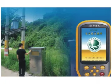
The land law enforcement’s timeliness requires staff to make their rounds frequently about the land utilization status in their responsible areas, so that they can detect land violations and nip them in the bud. Hi-Target Hi-Q land law enforcement patrolling software will make standard procedures according to the real circumstances, including patrolling path navigation, land area measurement, boundary redline comparison, illegal events reporting, taking photos and collecting evidence on the scene and wireless data synchronization, thus meeting all the demands of real-time land law enforcement patrol. Land inspectors are navigated by the base map and default route to patrol in real time. When they find illegal events, they could position and measure on the scene, then compare the measured results with planned data, taking photos and creating a report, upload to the administration center through integrated 3G wireless communication in the Q series products.

3、Administrating on the Internet(GIS)
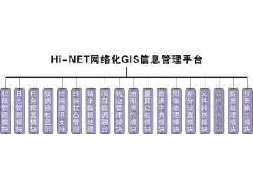
The main technical problem with land law enforcement is the integrated management of dynamic monitoring of land utilization, automatic collection of field data and land law enforcement information. Based on GIS technology, Hi-Target Hi-NET land law enforcement monitoring management system can combine the location data and property data of land (land type, ownership, four boundaries, land price and planning) with real-time illegal events report and files of illegal events, presenting to the users quickly, accurately and in both pictures and compositions according to the practical needs of the supervision of law enforcements. Depending on the quick query of space data, analysis and visual presentation, it can perform effective supervision and management of land law enforcement.
Hi-NET real-time supervision of land law enforcement management system can perform tasks such as authority management, cruising tracks real-time display and replay, online patrolling assignment, management of patrolling staff journals, inquiry and analysis of events in history and illegal events report.
Hi-Target is a manufacturer of GIS land surveyor in China; our products include GIS land surveyor, echo sounder and GNSS RTK system. We offer high-quality products at competitive price. Our company is based in China, and our full chain of manufacturing dual frequency RTK, split type and RTK system can be completed in China, even in one city. Lower manufacturing cost saves your purchasing cost. More details of each product are shown on the corresponding page with description.
Links:https://globefindpro.com/products/110210.html
-
 Portable Variable Optical Attenuator
-
 Optical Fiber Jumper, Connector
-
 GIS Water Surveyor
-
 Optical Fiber Adaptor / Optical Fiber Converter
-
 GIS Network Management System
-
 GIS Surveyor for Electric Power
-
 K7 Marine Location and Orientation Instrument (Integrated Type)
-
 Thermo Blister Machine (DPB-250R)
-
 Servo Blister Packing Machine (DPB-140C)
-
 Automatic Cartoning Machine (ANTZ-120P Bottle Sorting)
-
 Capsule Orientation Device (JD Series)
-
 Semi Automatic Capsule Filling Machine (CGN-208)
