GIS Network Management System
GIS NetworkManagement System
Main advantages
1 Professional basicGIS data processing ability
2 Real-time network GIS data processing ability
3 Module designed fast industry standard customized function
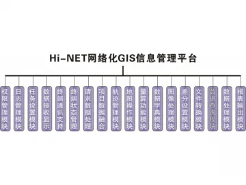
Hi-NET networking GIS information management systemis a high efficient solution which integrates GIS data collection, GIS datamanagement, data telecommunication and online office decision. It not only ownsvarious basic functions such as GIS data collection and processing, but canalso realize your omnipotent stage of real-time management of GIS informationnetworking.
Basic GIS functions: Fasterdictionary build-up and edit; browse and edit large amount of vector data,powerful image data match and pre-process function; various layer management,symbols rendering and property inquiry function; many kinds of data seamlesslyswitching, such as shp, mif,dxf, txt, csv and xls; powerful GPS data post processing function, adaptivematch high precision post differential data.
Network GIS function: Hierarchical system management throughsetting user authority; use log management to record real-time terminal loginand working status; various task assignment function, including message,multi-media, email and forms; real-time display the GPS track of terminal, canbe inquired and replayed by time; multi-terminal management supported, canreal-time update data base with the uploaded GIS data, support resume frombreak point; powerful space data inquire, statistics, and analyze function,provide fast and accurate decision support; module design, can quickly realizethe standard customization of industry application system, support severalformats of industry standard report output.
User permissions management with security and encryption
Image processing technique based on GIS
Various ways of releasing orders
Standardized flow with characters of the industry
Intuitional supervision system of operation processing
Powerful data real-time process function
Hi-Targetis a manufacturerof GISnetwork management system in China; our products include GISnetwork management system, SBAS receiver and integrated intelligent static GPS. We offer high-quality products atcompetitive price. Our company is based in China, and our fullchain of manufacturing marine positioning products and RTK system canbe completed in China, even in one city. Lower manufacturing cost saves yourpurchasing cost. More details of each product are shown on the corresponding pagewith description.
Links:https://globefindpro.com/products/110217.html
-
 GIS Surveyor for Electric Power
-
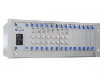 Flat Top Tunable Optical Filter
-
 Optical Light Source
-
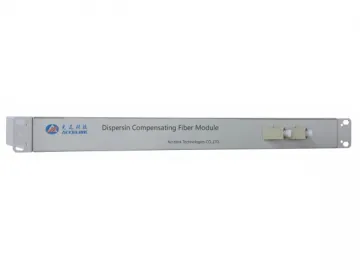 Benchtop Digital Variable Optical Attenuator
-
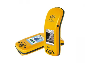 Q5 GIS Data Collection Solution (Handset Data Collector)
-
 ASE Broadband Light Source
-
 Optical Fiber Adaptor / Optical Fiber Converter
-
 GIS Water Surveyor
-
 Optical Fiber Jumper, Connector
-
 Portable Variable Optical Attenuator
-
 GIS Land Surveyor
-
 K7 Marine Location and Orientation Instrument (Integrated Type)


